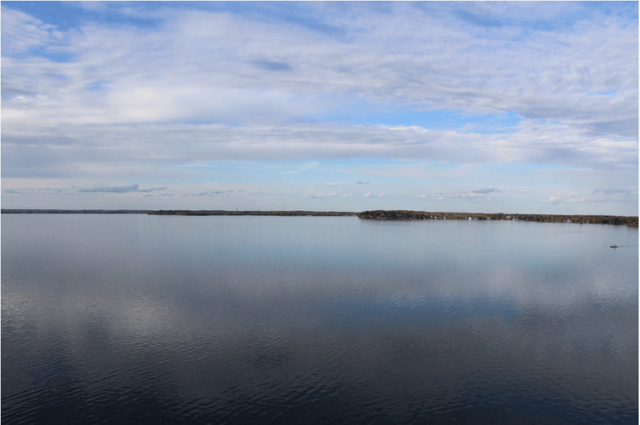
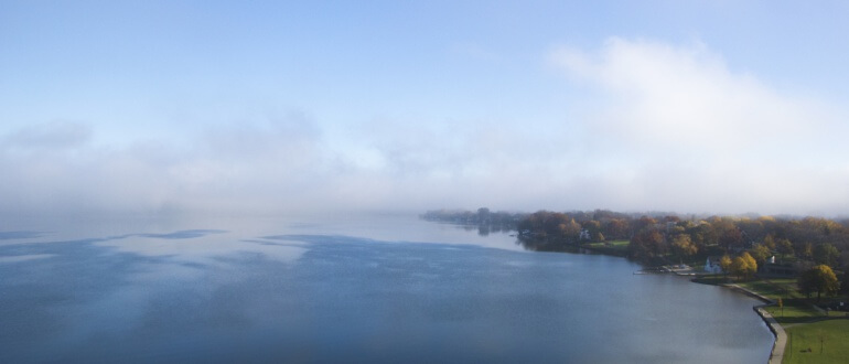
Lake Mendota is the largest of the lakes in the Yahara chain. The watershed surrounding the lake is primarily agricultural, including many fourth and fifth generation dairy farms to the north, but is experiencing rapid urban growth.
Phosphorus that enters Lake Mendota from its tributaries are carried down the chain of lakes via the Yahara River and represent the largest sources of excess nutrients in the lower lakes. To improve water quality in the chain of lakes, we need to make improvements in the land surrounding Lake Mendota.
Lake Mendota Median Phosphorus
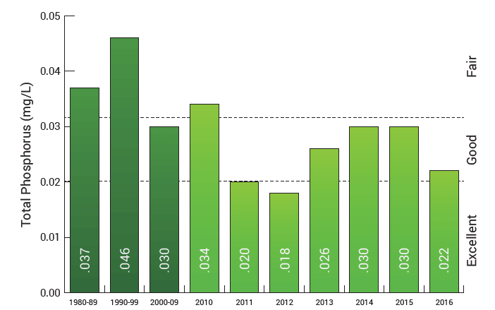 2016 Phosphorus Levels: 0.022 mg/L (Good/Excellent)
2016 phosphorus were good in all the lakes and close to excellent in Lake Mendota, according to Wisconsin Department of Natural Resources criteria. The conditions we experienced in 2016 represent what we hope to achieve on a consistent basis by continuing to reduce phosphorus loading into the lakes.
Lake Mendota Median Clarity
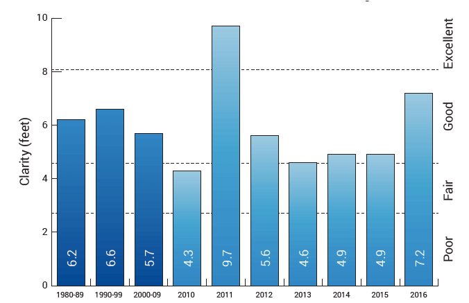
2016 Water Clarity: 7.2 feet (Good/Excellent)
2016 clarity conditions were good in Lake Mendota, according to Wisconsin Department of Natural Resources criteria.
Water Temperature
Water temperature can impact summer water quality because blue-green algal blooms tend to proliferate in warmer temperatures. Lake Mendota water temperature in 2016 was slightly higher than the long-term median.
2016 Lake Mendota Beach Closures
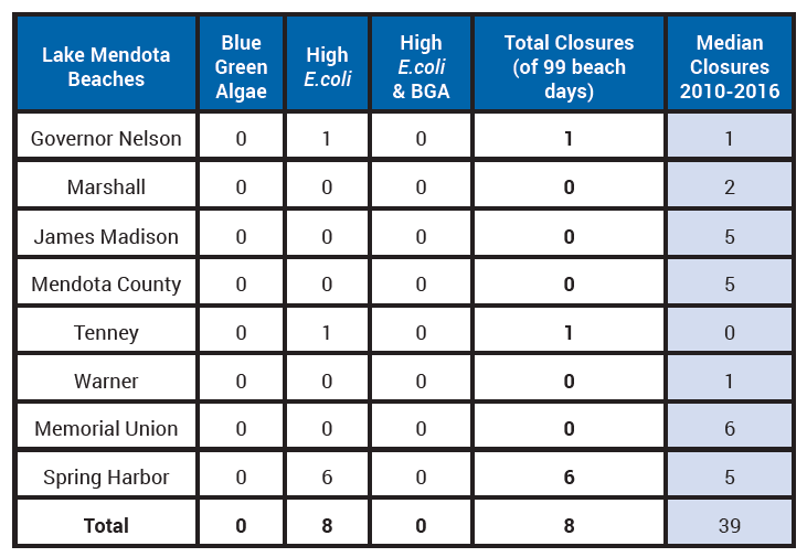
Source: Public Health – Madison & Dane County
Lake Mendota’s beaches were open most of the summer, with only eight beach days lost out of a total 792 possible days (99 days times 8 beaches). All of the closures were due to high E. coli levels. Spring Harbor lost six days and the Governor Nelson State Park and Tenney Park beaches were closed once each.
This post was originally published in the 2016 State of the Lakes Annual Report.